
Handheld GPS for Hiking, Rugged and Waterproof Handheld GPS Navigator, 3.2″ Sunlight Readable Screen, Compact Satellite Handheld GPS with USA Topo Map, Multi-GNSS Support, Extra Battery Life
$159.99
Related Products


From the brand


Handheld GPS Units

A6 Hiking GPS

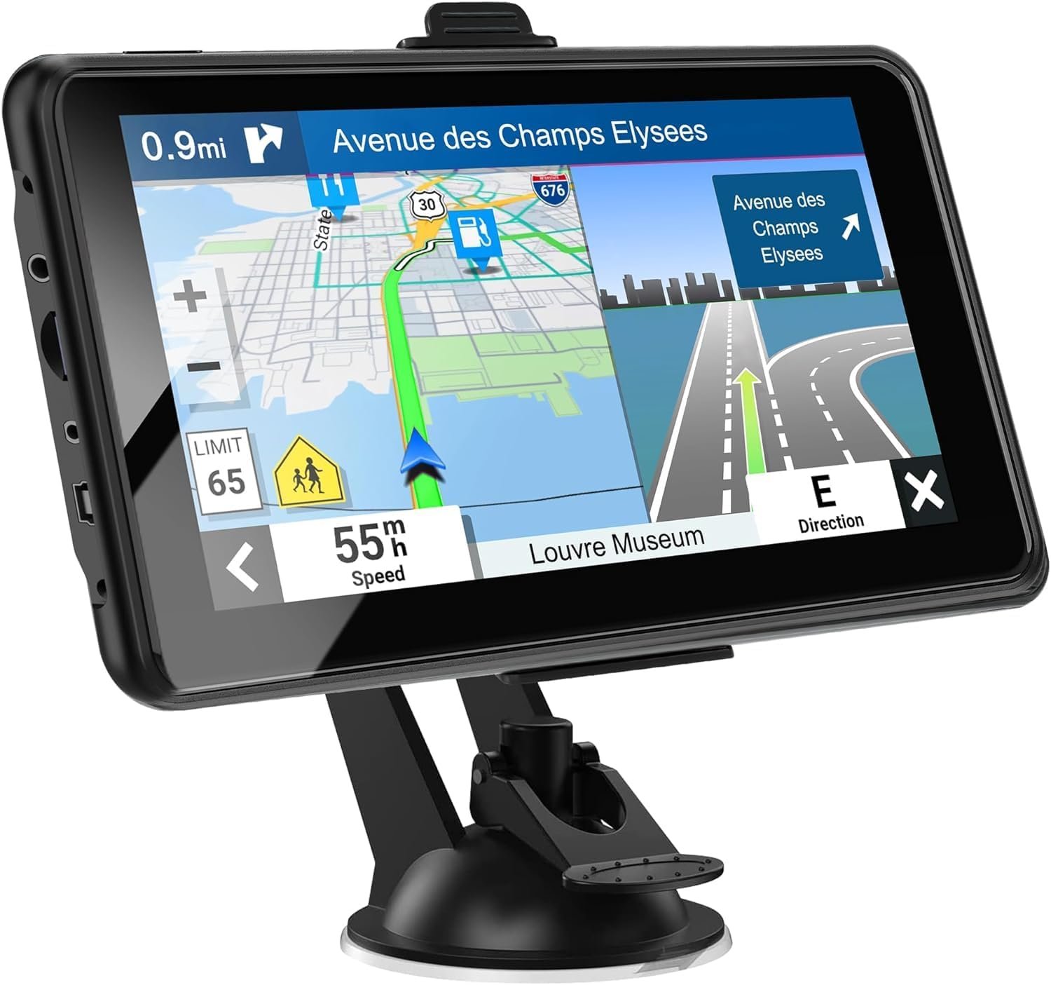
Handheld GPS Navigator

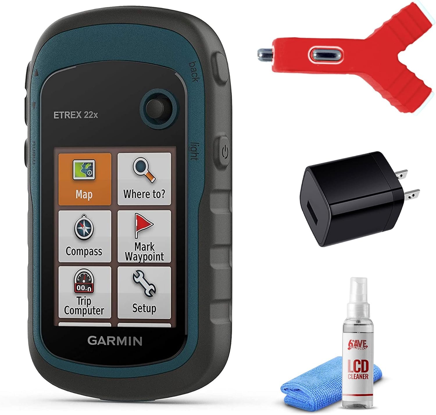
ZL-190PLUS GPS Surveying Equipment
ZL180 GPS Surveying Equipment

All NiesahYan products come with 2 years after-sell service
How do we start?
Our team consists of a group of engineering professionals whose constant exploration of new technological areas ensures that our products are at the forefront of the market.
What makes our company unique?
We firmly believe that product quality is the key to our success. This is a core belief that we have always held and it permeates all our decisions and actions.
Why do we love what we do?
Providing cost-effective GPS measuring tools and handheld GPS units for consumers around the world. Just give up the complex labor-intensive tools and making people’s lives easier and better!
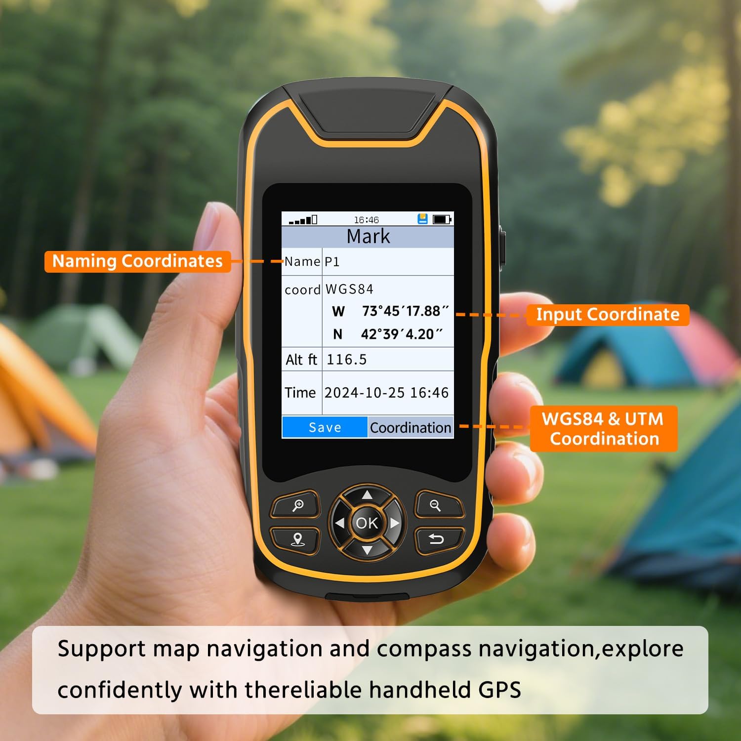
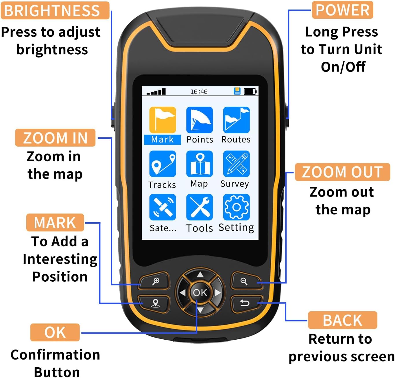
Compact and lightweight GPS handheld navigator boasts an anti-slip design offering a bright 3.2″ screen that is sunlight readable, even in bright sunlight, plus, physical buttons provide more versatility in any conditions
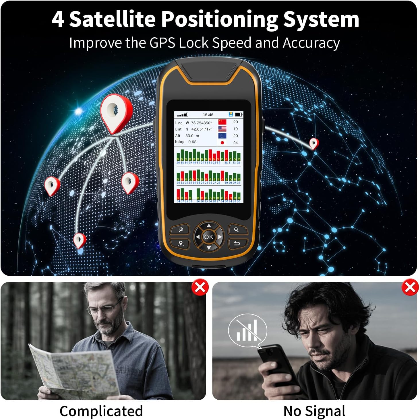
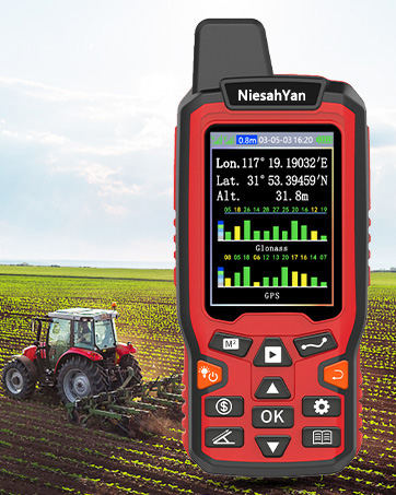
Get multi-GNSS support(GPS+GALILEO+BEIDOU+QZSS) for superior positional accuracy,so you know exactly where you are,location precision within 6 ft
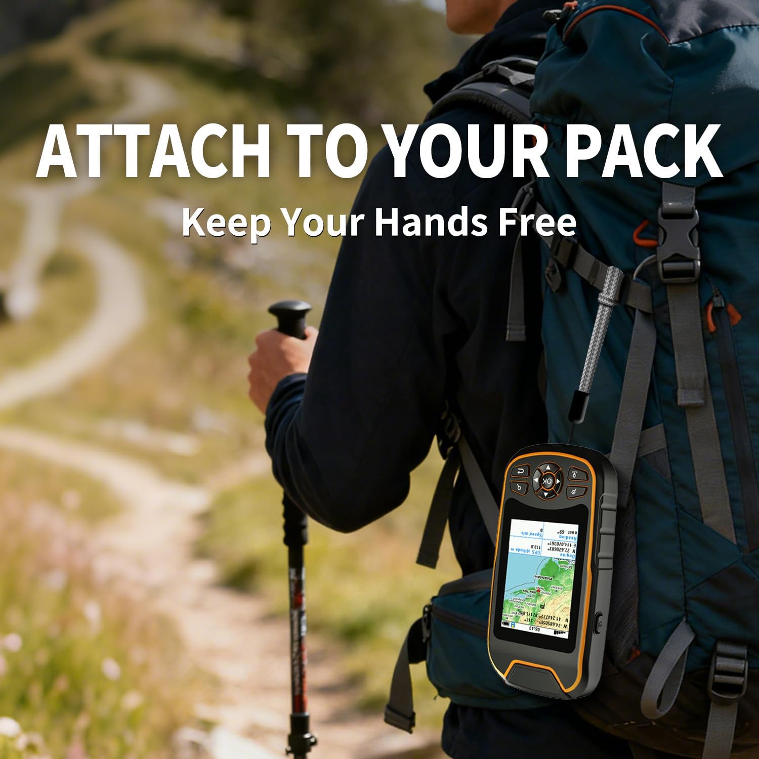
The handheld GPS navigator uses GPS technology to capture your trip or waypoint so you can guide back to your starting position
Equip with 3-axis compass and barometric altimeter,follow your bearing on the digital compass, which provides an accurate heading even when stationary
Hike in any weather with the water-resistant design (rated to IP66) ,Rechargeable battery can provide up to 36 hours of battery life in full charge, recharge easily with a standard USB-C cable
Preloaded with USA Topo maps for outdoor hiking and camping , 32 GB of internal memory for map downloads
8 reviews for Handheld GPS for Hiking, Rugged and Waterproof Handheld GPS Navigator, 3.2″ Sunlight Readable Screen, Compact Satellite Handheld GPS with USA Topo Map, Multi-GNSS Support, Extra Battery Life
Add a review
$159.99
Lee –
Have computer skills
I had to take it to someone to show me how to use it. Directions not to good. Even online directions are the same.
gsbobby –
Zoom in more
The GPS works real good. I just wished it would zoom in a little more on your position other than that. Satisfied with the product
Sue L. –
So glad I bought this
My fiance is a ADK 46rd He climbs almost every weekend. We lose at atleast one person a year to the Adirondacks. I get worried about him when he hikes. This has been able to give me a great peace of mind. My fiance is not a very technical person and he was able to figure out how to work this GPS with little to no effort. This was one of those gifts that you hope you’re loved one never needs it but the security of knowing they have it is worth every penny
Theodoros T. –
OK!
OK!
Benjamin A. –
All is good.
Love the item
Clifford Carnicom –
I was so hopeful, but alas….
A total bust and useless. I tried so hard with this company. I have purchased two GPS versions from this company. The first was so poor(UTM coordinates and zone incorrect, no bearings given, no proper Waypoint spatial plot, mirror imaging, no point naming, rubber C plug would not reset, about everything that could be wrong was. Only the lat long values for a given real time location were correct. So I decided to give them another chance and bought this higher end model. Still lots of problems, but also noticeably improved from the earlier version, at least for basic functions, and so I had higher hopes. Spent hours and hours learning what type of gpx file could be accepted (very primitive, version 1.0 gpx standards) so figured I could at least put it to basic use. First field test today. Entered one waypoint today and turned it off. Went to use for a second point, and the device will not boot up. Infinite loop up bootup screen and then shutdown. Cannot even turn off and on. Reset button has no impact (a hard reset button to factory defaults is required, not a soft reset like it has). It is not even going to be easy to return for me because of lifestyle, location and access to town services. Spent well over $350 on this company giving them a chance as Garmin deserves some competition but I do not have money to burn like this. Cannot even mildly recommend any products at this time; they need to do their homework more and also field test. The screen brightness, screen size, and legibility could have been a dream if it would have worked. Sorry Charlie, you can bet I tried more than you would ever know….
Yan Carlos Jiménez Castellanos –
Cumple con lo que dice
Comprado desde Colombia para hacer medidas de diversos predios, de momento bastante bien, no tiene nada que ver qué sea de estados unidos los mapas, trazar rutas, tomar puntos, medir áreas, todo bastante intuitivo
Pawel –
First GPS unit, not too bad
First one that I have owned. It’s pretty rugged but I think for me it would be nice if there was a clip. Batter so far has lasted a long time. Older graphics but pretty functional and easy to operate. The zoom feature on can definitely do better. It’s hard to see the map on the small screen. Favorite feature would be the survey feature. Figuring a square area and so on. It’s pretty nice and accurate.Takeaways:1. Don’t switch maps in a low2. Auto select time zone doesn’t adjust the clock3. If your names are displaying in a different language, reload the map. Should fix it. No language adjustment in settings that I could find.4. Comes preloaded with US maps per state. Loading more seems complicated but didn’t try it. Something to consider taking it abroad5. Make sure to change the units (km vs miles, etc)