
Garmin Montana® 710, Rugged GPS Handheld Navigator with Large 5-inch Glove-Friendly Touchscreen, Satellite Imagery and Maps for Routing on Roads and Trails
$538.99
Related Products
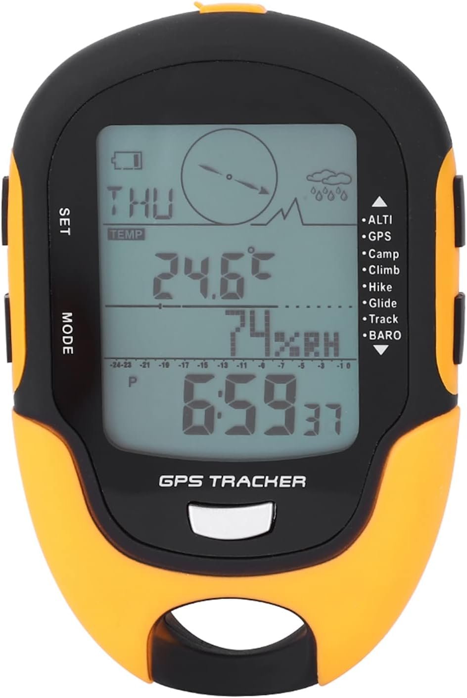

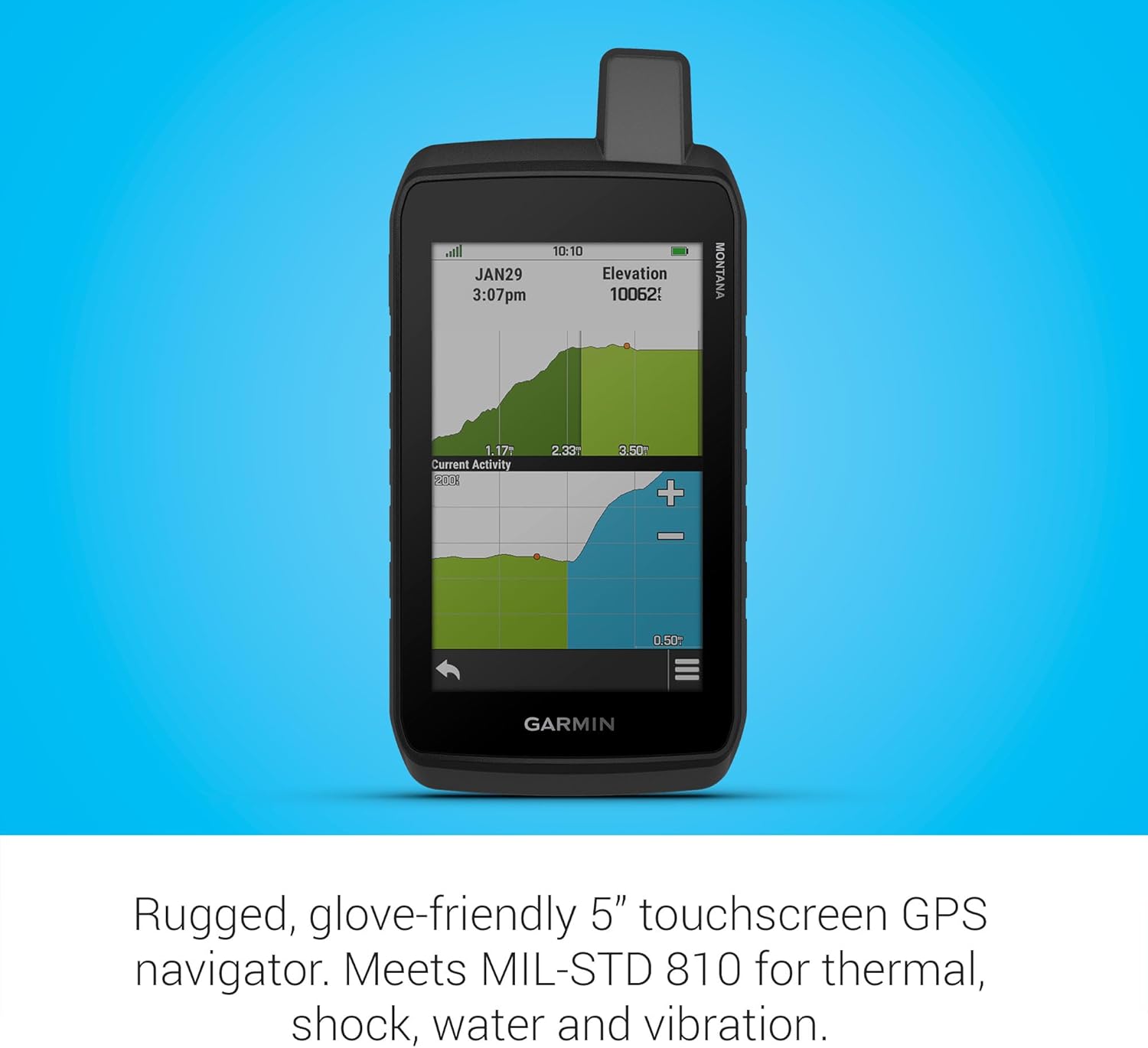


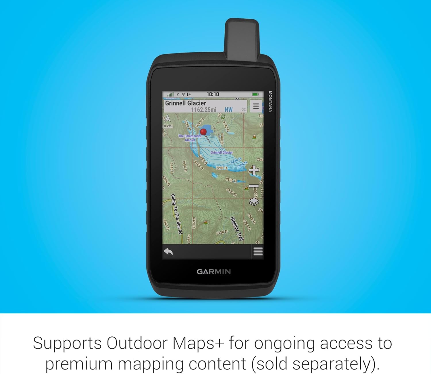
Stay on track with the rugged Montana® 710 handheld GPS navigator. Built to guide you through all kinds of adventures, it includes TopoActive mapping and a glove-friendly 5” color touchscreen. Expanded 32 GB memory capacity lets you store more maps to keep your expeditions on course. High-resolution satellite imagery, available via subscription-free, direct-to-device downloads (requires a connection with Wi-Fi® technology), shows a clear overhead view of your route and surrounding terrain. Get the on- or off-road capabilities you need with multi-GNSS satellite network support and ABC sensors. Add ongoing access to Outdoor Maps+ (sold separately) for a wide variety of premium mapping content. Explore longer with up to 24 hours of battery life in GPS mode and up to 432 hours in ultralow-powered expedition mode, and recharge easily with a standard USB-C® cable. Plus, Montana 710 meets MIL-STD 810 for thermal, shock and vibration and is rated IPX7 for water-resistance.
5” glove-friendly touchscreen handheld GPS navigator with easy-to-view color display; available with versatile mounting options (sold separately), depending on your activity
Navigate your adventures with included TopoActive maps and the ability to download additional maps, such as City Navigator maps for streets and BlueChart g3 charts for water (sold separately)
Rugged construction is rated to MIL-STD 810 for thermal, shock and vibration and IPX7 for water-resistance
Downloadable high-resolution satellite imagery shows photorealistic overhead views and lets you create waypoints based on landmarks
Expanded 32 GB memory capacity lets you store additional maps and more to keep your expeditions on course; with a subscription to Outdoor Maps+ (sold separately), get ongoing access to a wide variety of premium mapping content, which you can download to your navigator via Wi-Fi technology
Compatible with the Garmin Explore smartphone app to plan and review trip data; also manage your waypoints, courses and activities
Rechargeable lithium-ion battery pack can provide up to 24 hours of battery life in GPS mode and up to 432 hours in expedition mode between charges; can also be powered with traditional AA batteries (not included)
Recharge easily with a standard USB-C cable
Built-in ABC sensors help you navigate your next trail, including an altimeter for elevation data, barometer to monitor weather and 3-axis electronic compass
Access up-to-date active weather forecasts via the Garmin Connect app on your compatible smartphone
13 reviews for Garmin Montana® 710, Rugged GPS Handheld Navigator with Large 5-inch Glove-Friendly Touchscreen, Satellite Imagery and Maps for Routing on Roads and Trails
Add a review
$538.99
Scott Liske –
Replaced a lost 750i
Nice to have universal C style charge now. As with any new gps, getting your maps loaded, then all the settings. I had a 750 so its the same basic unit
Heinz –
The touch screen is a great Improvement from older handhelds
I upgraded from a Garmin 76CXs which is more than 20 years old. Using Basecamp I was able to download all of my waypoints from my old Garmin. I was then able to upload them into the new 710. I really like this screen and the ability to use your fingers to move the map rather than that old style button to move the cursor it’s much faster and precise. I was also able to use old maps that I had purchased on CDs. I installed the Topo Canada maps using my CDs which only installs into mapsource, which is not supported by Garmin anymore and replaced by basecamp. You have to get the very latest update of mapsource which I think is 2010. Once your cd maps are installed in Mapsource the maps will show up in basecamp. Then using map install in Basecamp I was able to install the entireTopo Canada into my new 710. It worked well but I’ve learned that you cannot delete the Topo Canada maps that I installed using the handheld there’s no way to delete them out. You have to hook it up to basecamp again to uninstall anything that you put in using Basecamp. You can modify and delete waypoints using only the 710 that you put in using Basecamp but not maps themselves.There are some quirks with the software that I am hopeful will improve over time to make it more user friendly, but this handheld was only released a month and a half ago so it’s pretty new.Overall I’d say I’m happy with the unit I plan on taking it up to a remote large lake in Canada to go fishing this spring and I’m looking forward to using it.
M. Brady –
What I said
Yeah, I honestly don’t know why I bought this. Physically it’s beautiful but while using it it just seems old. It’s all laggy and the camera sucks. Unfortunately, cell phones are so advanced now that these are almost obsolete so they really need to innovate and figure something out.
Amazon Customer –
Great GPS
I bought this to replace my Montana 600 which was failing and was too old for repair.I’ve found this unit t o be great for hiking, traveling.,and Geocaching. It’s all I could ask for in a handheld unit.
Darn Reddick –
Garmin still doesn’t take this portion of their business seriously.
This is just another extrapolation of their old Rino line. I’ve been a customer since before iPhone Nothing has improved with these guys in over a decade. This thing is buggy as ever and the supporting software and map making program have gone backwards. at my income level it would hav e cost more in my time that the thing is worth to describe all that is wrong with this. Garmin has lost its way. I hope their commercial aviation and marine products are taken more seriously.
Victor Guerrero Torres –
Muy buen producto
Llego bastante rapido, pude instalar los mapas de Chile y Suramerica sin problemas, ahora solo queda aprender a usarlo lo mejor posible.
BL –
Top-notch touchscreen but Receiver Sensitivity is not as good——
This Montana 760i has a top-notch touchscreen. But:(1)Receiver Sensitivity is not as good as Oregon 450.(2)Determining the elevation takes several hours.(3)Because plastic aging, the non-slip coating will become sticky coating after several years.(4)It frozen once after 2 hours of use, needs to reboot.(5)After fully charged, Continues to consume 300mA current. Therefore, it might overcharge.
Vrayju –
Excelente equipo
Excelente equipo. Buena precisión en ciudad falta verificar en selva
MARK D –
Thought this would do it all sat nav navigation for walking for start if your in Britain buy one in Britain they bring these in from America and they don’t have european city maps which are nearly £80 trying to download european topo maps keeps stopping because it wants to work through a computer then when you think it has finished after several hours it hasn’t download failedIn short dont bother to buggy to expensive and after 8 hours I’m no more closer to understanding the thing then when it was left on the door step if it doesn’t start working ill send it back to amazonAt this price no matter what it promises it doesn’t even work not with expert knowledge and a computerDisappointing is not the word expensive and overly complicated
سماهر –
سيئ
Michael –
This thing is not what i hoped for. I dislike it so much, it may have knocked me off of my tendency towards Garmin overall. I am on my fourth Garmin smart watch. Likely my last. Bought this for motorcycle on road/off road and thought could also use for hiking so did not get dedicated motorcycle unit which was clearly a bad decision. Terrible for hiking and ok for motorcycle. Even when lock in portrait view in settings, still tries to go to landscape while riding. but that is one of many complaints. Think Garmin put C team on this product because use their products for flying and they are fantastic so know they can do things well. Have to admit do like my Instinct 3 though. Could not justify price for latest Fenix given length of time i keep them.
Dean P. –
Exactly the same as the discontinued 700 but 32gig memory instead of the 16 in 700. Processors are the same so still slow running and crashing.
Rick H. –
As the owner of several GPS devices, satellite phones, etc., I can say this device is certainly feature rich but it is also poorly documented and often hard to figure out. The interface and most functions seem to have been designed by accountants and young Geeks rather than actual users.All Birdseye satellite data previously downloaded onto an older Garmin device will have to be re-downloaded from Garmin onto the 760i; either directly or using BaseCamp. There is no rational reason why that downloaded data now residing in BaseCamp on my computer (downloaded for an older Garmin device) cannot simply be transferred to the 760i instead of having to re-download it all into BaseCamp again for the 760i and no explanation is provided by Garmin support. In summary – good graphics but lots of clunky features.